
TAKE OFF WITH TPA’s DRONE SURVEYING
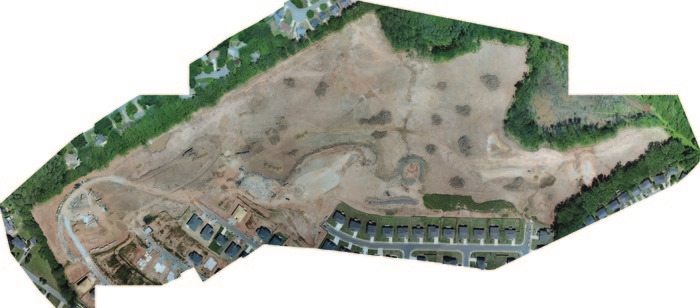
TPA is now providing UAV (Unmanned Aerial Vehicle) Surveying. Using our Phantom 4 multi-rotor drone with 20 mega pixel camera, our team provides site inspection imagery and video, topographic mapping and orthographic imagery for a variety applications. A recent drone mission completed the field work required to prepare a 30 acre topographic map in less than four hours. After a day of processing in the office, the topographic survey and supporting orthographic image was delivered. The field effort and flight was conducted during ongoing construction and clearing activities, without interrupting site operations and provided an accurate snapshot of site conditions on the site for the day of the flight. To see a PDF of the image for this survey, click here.
For more information, or to discuss how an aerial approach to your project might be of benefit, please contact Kevin Pate, LSI at 770-695-3369 or email Kevin at kpate@travispruitt.com.